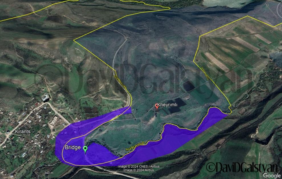
The authorities of the Republic of Armenia are actually ready to hand over 18 billion square millimeters of the territory of the Republic of Armenia to Azerbaijan
Journalist Davit Galstyan published a map of the demarcation area in Tavush on his Facebook page, stating: "The Armenian authorities are actually ready to hand over 18 billion square millimeters of Armenian territory to Azerbaijan in Kiratz.
Since the representatives of the government like to repeat that "in Tavush, not a single millimeter of territory is ceded from RA", then let's count in mm.
* RA authorities announce that the Soviet borders are restored in Tavush.
* The territorial boundaries in this section correspond to the map of the RA Cadastre Committee.
The ruling elite knows it, the residents of Kirants know it much better.
* The government refers to the data of the same Cadastre Committee, claiming that the territory of former Azerbaijani villages does not belong to Armenia.
* According to the Cadastre Committee, Manushakagayun is the territory of the Republic of Armenia, which remains under the control of Azerbaijan (along with Kaptavun) after "delimitation" according to the map of the Government of the Republic of Armenia.
The purple part is about 0.18 sq km or 180 000 000 000 sq mm.
P.S. Since the border is a very "thick" line on the government's map, I'm sorry, it could be a few billion sq mm on the east side / east side."
Add new comment