Oversight of "wrong" cadastre documents and border
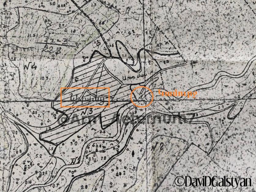
Journalist Davit Galstyan published a map of Tavush marz, writing: "In this piece of map/copy (marked as 1980), the Kirants bridge and the surrounding area belong to the ASSR/RA.
The map was prepared by the state design institute "Haypethoghshinproject"
I spoke with the former director of the institute, Sergey Harutyunyan (during both the USSR and RA years). In the 80s, together with Vladimir Movsisyan (Deputy Chairman of the Council of Ministers of Soviet Armenia), he personally participated in the process of adjusting the entire border with Azerbaijan.
* "Haypet Hoghshshinnakheit" operated under Gyungakh of ASSR, it was an official structure.
* The maps they made coincided with the maps of Moscow and Baku. In Azerbaijan (and not only) there was the same institute, he created it ("Азгипрозем").
* The SSR of the USSR used the same maps (of the Institute of Geodesy), but they drew the borders based on their expediency.
They were not relied upon when determining the borders. That is why there has never been such a border in Kirantz.
* This same institute in 1983. issued the "General scheme of land use of the Armenian SSR until 2000".
1984: "Cadastral assessment of the lands of the Armenian SSR".
* The institute continued to function even after the collapse of the Soviet Union. The cadastral documents were given to the villagers with the participation of their maps and their commission.
* Harutyunan excludes that the cadastral papers were issued on the territory of the SSR of Azerbaijan in Kirantsi or at another border location.
* The Cadastre Committee is currently using the maps of the "Haypet Land Project" and the Institute of Geodesy.
"The houses given to Azerbaijan in Shurnukh were in the territory of the ASSR."
Add new comment